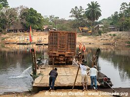
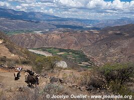
Road from Buena Vista to Concepción
Argentina
Argentina
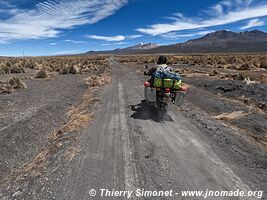
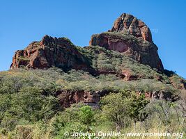
Parque Nacional El Leoncito
Argentina
Argentina
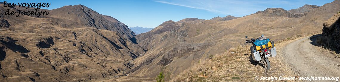
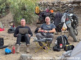
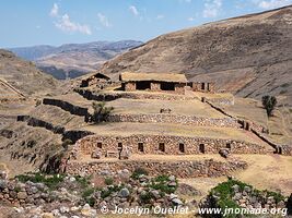
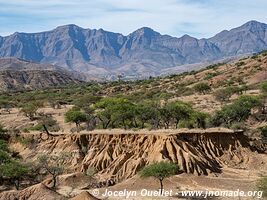
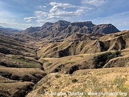
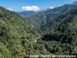
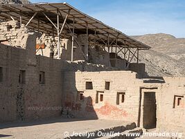
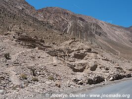
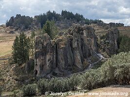
Trail Santiago from Chuco to Pampas (mining area)
Peru
Peru
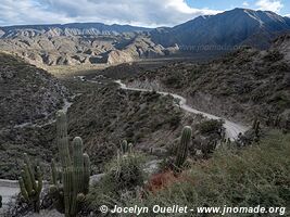
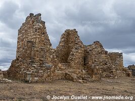
Parque Nacional Los Cardones
Argentina
Argentina
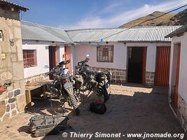
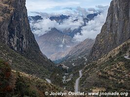
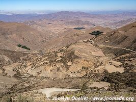
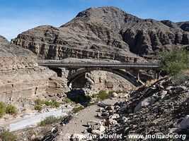
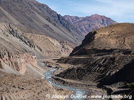
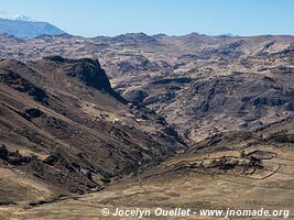
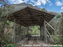
Road from San Mateo de Huanchor to Tanta
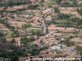
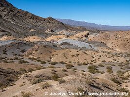
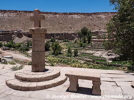
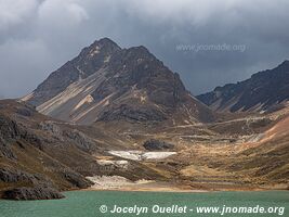
Nor Yauyos-Cochas Landscape Reserve
Peru
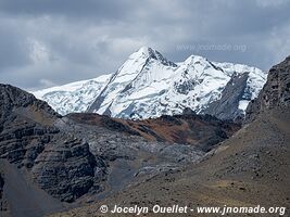
Nor Yauyos-Cochas Landscape Reserve
Peru
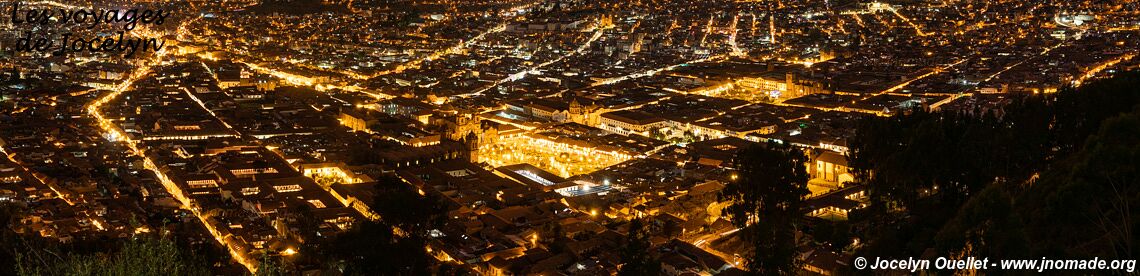
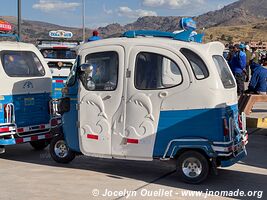
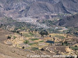
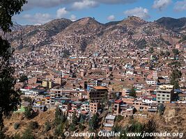
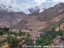
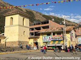
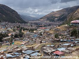
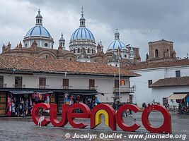
Cusco
Peru
Peru
South America 2019-2023
unknown length - solo travel - Suzuki DR650
Latest news:
This journey is the continuation of the trip that began in section Quebec to Panama 2017-2019.
This journey is completed. Consult the map for the entire route.
Most recent posts:
—
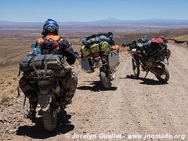
Nov 1, 2022 — Bolivia 3
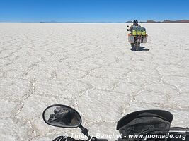
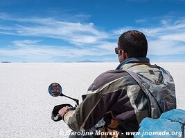
Here we are at the famous Salar de Uyuni. Even though I've already been to the salar in 2019 and also in 2005, I had to bring the two Thierry's, because...
—
Oct 27, 2022 — Bolivia 3
Laguna Coipasa, surrounded by the Salar de Coipasa, is a salt lake no more than 3.5 metres deep. It is difficult to access, as to get close you have to...
—
Oct 25, 2022 — Bolivia 3
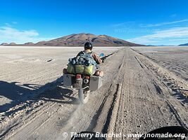
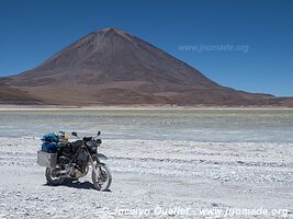
We leave Sajama Park heading south. We drive all day at an altitude of over 4,000 metres. The semi-desert landscapes are beautiful despite their austerity...
—
Oct 23, 2022 — Bolivia 3
After two days at average altitudes below 2,500 metres, we're back on the Altiplano plateau. To get to Sajama, we had to do a lot of driving through a...
—
Oct 21, 2022 — Bolivia 3
After descending the Death Road, we drive for a while along the flanks of the Andes at altitudes ranging from 1,000 to 2,000 metres, before climbing to...
—
Oct 19, 2022 — Bolivia 3
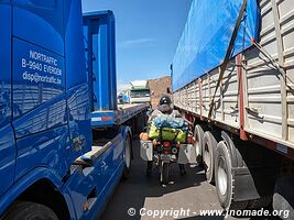
After crossing the border, we thread our way through the stationary trucks. A strike at the border crossing brought freight truckers to a standstill...
—
Oct 17, 2022 — Peru 2
Puno is a small town on the shores of Lake Titicaca. At an altitude of 3,820 metres, the climate is cool but pleasant. We made a brief stop there for...
—
Oct 15, 2022 — Peru 2
We've been travelling through the high mountains of Peru for a week now. The scenery is often breathtaking, yet we've seen no other travellers on these...
—
Oct 11, 2022 — Peru 2
We continue our journey through the Peruvian countryside, taking in some magnificent scenery...
—
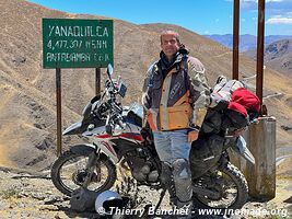
Oct 9, 2022 — Peru 2
I continue my journey with the two Thierry on high mountain trails. As you can see from the photo, we're at a pass at almost 4,500 metres altitude. One...
—
Oct 7, 2022 — Peru 2
I've been wanting to explore Patagonia and Brazil for quite some time now. So why am I taking to the roads of Bolivia and Peru? Quite simply, to ride...
—
Oct 6, 2022 — Peru 2
The name Sóndor comes from «Suntur Wasi» in Quechua and means «house of the condor». It was built by the Chanka culture (AD 1000...
—
Sep 27, 2022 — Peru 2
Over a million people visit Cusco and the famous Machu Picchu every year. Despite this incredible number, I saw virtually no tourists on my loop north...
—
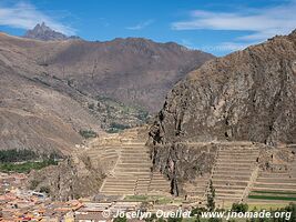
Sep 24, 2022 — Peru 2
Ollantaytambo is an ancient Inca fortress and archaeological site located in Peru's Sacred Valley. A UNESCO World Heritage Site, it dates back to the...
—
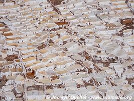
Sep 23, 2022 — Peru 2
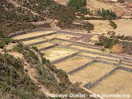
Salinas de Maras is a salt extraction site dating back to pre-Incan times. The site includes some three thousand terraced salt pans where mineral-rich...
—
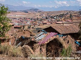
Sep 22, 2022 — Peru 2
In addition to the ancient Inca ruins, Chinchero is also a large Peruvian village. Juxtaposed to the archaeological site, the Spaniards built a beautiful...
—
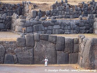
Sep 21, 2022 — Peru 2
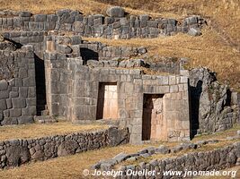
Saqsaywaman, also called Sacsayhuamán, is an archaeological site located near Cusco. It was built during the 15th century. It served as a fortified complex...
—
Sep 19, 2022 — Peru 2
Tambomachay is an archaeological site of the Inca Empire. It is also known as El Baño del Inca or 'The Bath of the Inca'. It is formed by a series of...
—
Sep 17, 2022 — Peru 2
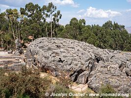
This archaeological site located 30 km east of Cusco is a fortress of ancient Peru dating back to the pre-Inca period. The site was an important place...
—
Sep 14, 2022 — Peru 2
After the jungle in Bolivia and Peru, it's a return to the Andes. Over a distance of less than 200 kilometres, I went from an altitude of 257 metres at...
—
Sep 6, 2022 — Peru 2
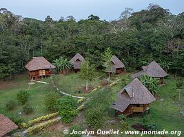
For 3 days I explored the Peruvian jungle in the Tambopata National Reserve. My main goal was to go to Collpa Chuncho where you can observe the beautiful...
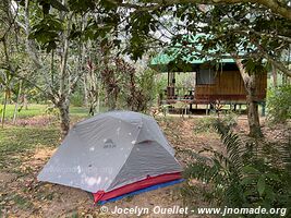
—
Sep 4, 2022 — Peru 2
In Puerto Maldonado, I stayed at this small lodge before taking a trip into the jungle of the Tambopata National Reserve. It was a very quiet stay as...
—
Aug 28, 2022 — Bolivia 2
The far north of Bolivia was interesting despite the oppressive heat, humidity and dust on the roads. With temperatures hovering around 35 degrees Celsius...

—
Aug 23, 2022 — Bolivia 2
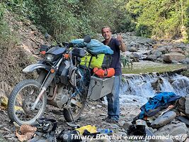
Travelling through the Amazon basin, I thought I was going to be riding on beautiful roads surrounded by lush rainforest and exotic animals. My experience...

—
Aug 10, 2022 — Bolivia 2
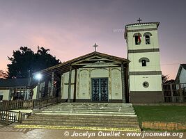
The seven Jesuit missions on this circuit were forgotten for over two centuries. In 1986, the release of the film The Mission, starring Robert de Niro...
—
Aug 8, 2022 — Bolivia 2
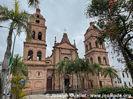
Santa Cruz has a population of about 1.9 million (3.8 million for the whole metropolitan area). It lies at the foot of the Andes Mountains, in the llanos...
—
Aug 5, 2022 — Bolivia 2
After three weeks in Tarija, I hit the road again in the Bolivian backcountry. I passed through roads not often used by travellers. In a few days, I drive...
—
Jul 20, 2022 — Bolivia 2
On the way out of the Cordillera de Sama, there are impressive views of the villages of San Lorenzo, Rancho Norte, San Mateo and the city of Tarija in...
—
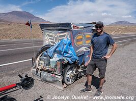
Jul 11, 2022 — Bolivia 2
The itinerary I had chosen for visiting the Cordillera de Sama Biological Reserve turned out to be more complicated than anticipated. I had planned to...
—
Jul 10, 2022 — Bolivia 2
Small loop in the far south of the country, in the department of Tarija...
—
Jul 9, 2022 — Bolivia 2
The trail to the Tariquía Reserva climb about 1000 metres from the village of Padcaya to the start of the reserve itself. I already added this place...
—
Jul 7, 2022 — Bolivia 2
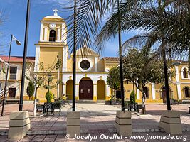
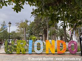
The Valle de la Concepción is the heart of the Bolivian wine region. In order to taste some of the country wines, I stopped in the village of Uriondo...
—
Jul 6, 2022 — Bolivia 2
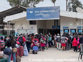
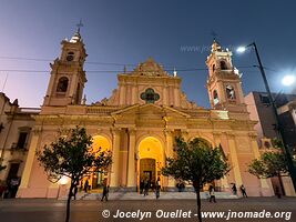
After my stay in Salta, Argentina, I head directly to Bolivia passing through the border at Yacuiba (Bolivia) and Professor Salvador Mazza (Argentina)...
—
Jun 28, 2022 — Argentina
The Cuesta del Obispo is a portion of the road between Cachi and Salta with a length of about 20 kilometres. It peaks near the Piedra del Molino at an...
—
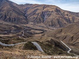
Jun 26, 2022 — Argentina
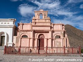
After leaving Los Cardones Park, on the way to Cachi, this mirador offers nice views on the mountains. Cachi is a pretty village in the Valles Calchaquíes...
—
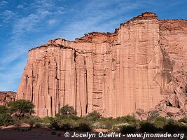
Jun 24, 2022 — Argentina
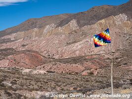
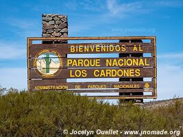
Los Cardones National Park, near the towns of Cachi and Payogasta, was created in 1996 to protect various biomes located at altitudes between 2,600 and...
—
Jun 23, 2022 — Argentina
The small village of Seclantás is within the Valles Calchaquíes along Ruta 40. Its population is only around 300 people. This road takes its name from...
—
Jun 22, 2022 — Argentina
I leave Angastaco and I continue driving on Ruta 40 in the direction of Molinos. I reach the small village of Molinos around noon. Once there, I notice...

—
Jun 21, 2022 — Argentina
Ruta 40 from Cafayate to Molinos is a real treat for the eyes. The landscapes are fantastic and every time one thinks he has seen the best, he is wrong...
—
Jun 17, 2022 — Argentina
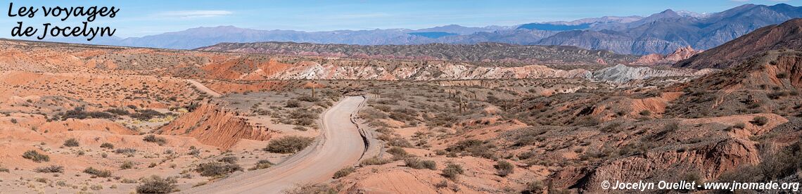
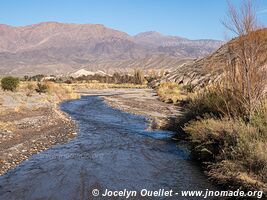
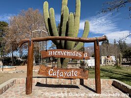
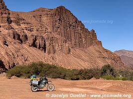
Quebrada de las Conchas, also known under the name Quebrada de Cafayate is a magnificent canyon located in the Valles Calchaquíes near Cafayate. The...
—
Jun 16, 2022 — Argentina
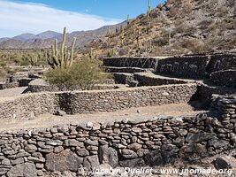
The ruins of Quilmes, also called the Sacred City of the Quilmes, is located at the foot of the Cerro Alto del Rey some 60 kilometres south of Cafayate...
—
Jun 15, 2022 — Argentina
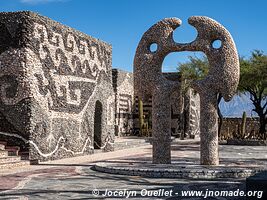
The Pachamama Museum in Amaicha del Valle is an interesting curiosity located on the way between Tafi del Valle and Cafayate. The museum offers four rooms...
—
Jun 12, 2022 — Argentina
The road from San Miguel de Tucumán goes through the spectacular gorge of the Los Sosas River. It sneaks it way along the river through a dense subtropical...
—
Jun 11, 2022 — Argentina
A few kilometres after the city of Andalgalá, I drive to the mountains via the Cuesta la Chilca. The word cuesta can be translated as 'slope' 'hill'...
—
Jun 9, 2022 — Argentina
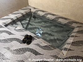
One of the attractions of the region is los Termas de Hualfín. It is a very basic place surrounded by fantastic scenery. On the site, it is possible...
—
Jun 8, 2022 — Argentina
Small trip from Villa Vil to the Laguna Blanca in the reserve of the same name. This reserve became a biosphere reserve in 1982. It protects several brackish...
—
Jun 7, 2022 — Argentina
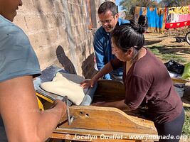
With the family where I stayed during my time in Villa Vil, I had the opportunity to learn about making bread in a traditional oven. Before the pandemic...
—
Jun 4, 2022 — Argentina
The town of Tinogasta is quite forgettable, but to the north, there are some old adobe (mud brick hardened in the sun) buildings worth a visit. The Oratorio...
—
Jun 1, 2022 — Argentina
Here are some photos of interesting sites along the way. The archeological site of Hualco dates from around DC 700 to 1000. It predates the arrival of...
—
May 31, 2022 — Argentina
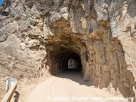
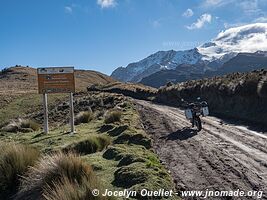
From the town of Famatina, 35 km north of Chilecito, a trail leads to the Mejicana Mine (station 9). The mine's entrance is located there, at an altitude...
—
May 25, 2022 — Argentina
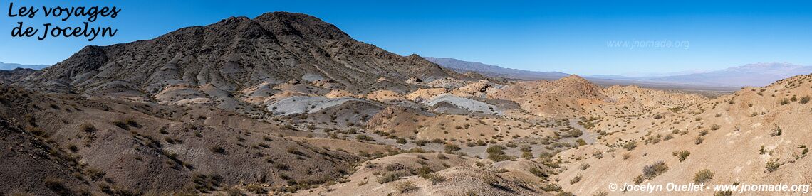
Talampaya is another spectacular park next to Ischigualasto Park. The main appeal of the place is the Talampaya Canyon with its vertical walls nearly...
—
May 23, 2022 — Argentina
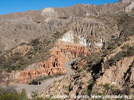
The Ischigualasto Park, also known as Valle de la Luna (Valley of the Moon), is a UNESCO World Heritage Site since the year 2000. It contains a variety...
—
May 18, 2022 — Argentina
In Barreal, I met again my Argentinian friends Christian and Silvina. It was Silvina birthday on that beautiful autumn day, and we lunched together on...
—
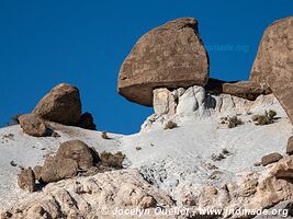
May 16, 2022 — Argentina
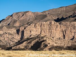
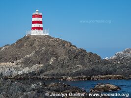
The El Leoncito Park offers magnificent mountain landscapes in a semi desertic environment. There are a few nice treks available, and two observatories...
—
May 12, 2022 — Argentina
From Uspallata, the road to Chile leads to the Paso Internacional Los Libertadores, a mountain pass linking Argentina and Chile. The old road climbs to...
—
May 11, 2022 — Argentina
The name is quite simple and means the 'hill with seven colours.' A trail that goes to Mendoza. I drove the first half of it to enjoy the scenery. The...
—
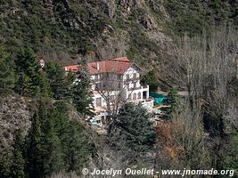
May 10, 2022 — Argentina
The road crossing the Villavicencio private reserve is an ancient way that linked Buenos Aires to Santiago de Chile during the colonial days. The Hotel...
—
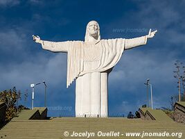
May 8, 2022 — Argentina
In the middle of nowhere, this huge Christo Rey appears on a hill. From the statue, the view on the plain and the Andes mountains is fantastic...
—
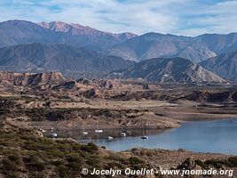
May 6, 2022 — Argentina
Construction of the Potrerillos Reservoir was finished in 2002 in order to provide hydroelectric power to Mendoza. It is located in the beautiful foothills...
—
May 4, 2022 — Argentina
The tiny village of Manzano Histórico, located at the foot of the Andes Mountains, protects fantastic scenery and rivers with pure water. It also has...
—
May 1, 2022 — Argentina
First travel day after the pandemic. I visit the Reserva natural y cultural Bosques Telteca, also known under the name Altos Limpios. The reserva protects...
—
Apr 20, 2022 — Argentina
Finally, it's time to travel again! After 2 years, 2 months, and 21 days, I once more set foot in South America in order to continue my trip that began...
COVID-19 pandemic... In Quebec for 2 years, 2 months and 21 days.
—
Dec 23, 2019 — Chile 2
During the Christmas and New Year's holiday season, I stayed in Santiago, the capital of Chile. In fact, I stayed there almost a month to relax and essentially...
—
Dec 21, 2019 — Chile 2
This village is one of the two access points for a visit of the Pingüino de Humboldt Reserve. From this place, it is possible to take a tour boat to...
—
Dec 19, 2019 — Chile 2
After my journey to the Nevado de Tres Cruces Park, I return to the coast for a few days.You will find that even though beaches in Chile are sometimes...
—
Dec 17, 2019 — Chile 2
The park Nevado de Tres Cruces is one of the hardest to reach in Chile due to its remoteness, and the lack of services in its surroundings.I successfully...
—
Dec 12, 2019 — Chile 2
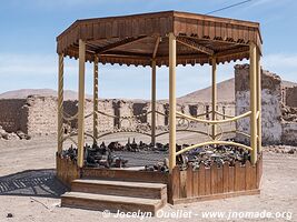
Chacabuco was a mining town at the time of the saltpetre-produced nitrate boom. It once sheltered up to 5,000 people, but it is now a ghost town with...
—
Dec 11, 2019 — Chile 2
After a detour through Bolivia, I am back in San Pedro to visit the last popular sites around town. The town in itself is not very interesting, but the...
—
Dec 9, 2019 — Bolivia
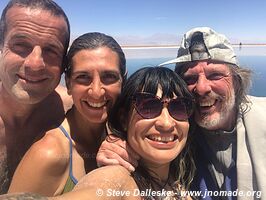
Here we go, all good things have an end... After a superb week with Caroline, it's time to part ways. I go back to San Pedro in Chile while Caroline continues...
—
Dec 5, 2019 — Bolivia
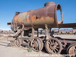
My journey with a partner ended in Uyuni, a small town right next to the salar. Next to the town, a nice train graveyard can be visited...
—
Dec 3, 2019 — Bolivia
With Caroline, the second leg of our journey in Bolivia was to drive on the Salar de Uyuni, the biggest salt flat in the world. It was an awesome experience...
—
Nov 30, 2019 — Bolivia
Here we are, in Bolivia, in the Eduardo Avaroa Andean Fauna National Reserve. Caroline and I just started the famous Ruta de las Lagunas. The altitude...
—
Nov 28, 2019 — Chile
In San Pedro de Atacama, in the Chilean desert, I met Steve and Priscilla, a couple from California. They bought motorbikes in Peru and want to go down...
—
Nov 25, 2019 — Chile
In the middle of the Atacama Salt Flat, the Laguna Chaxa is one of the most visited sites near San Pedro. In the morning, numerous tourists gather to...
—
Nov 21, 2019 — Chile
The region around San Pedro de Atacama is bursting with fantastic landscapes. During about a week, I make excursions for discovering high mountains, and...
—
Nov 20, 2019 — Chile
Looking at the map, you will notice I made a big detour through the city of Calama after leaving the El Tatio Geysers. I was not in need of any supply...
—
Nov 18, 2019 — Chile
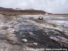
The El Tatio Geysers are a very popular attraction visited from San Pedro de Atacama. Over an area of 10 km2, one can admire numerous geysers, steaming...
—
Nov 17, 2019 — Chile
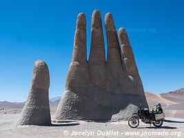
I am now heading in the backcountry and the high mountains of the Andes Mountains. I am still in the great Desert of Atacama which still offers me superb...
—
Nov 16, 2019 — Chile
La Noria is another oficina salitrera, a mining town where lives were revolving around digging for saltpetre used in nitrate plants.Nowadays, there are...
—
Nov 14, 2019 — Chile
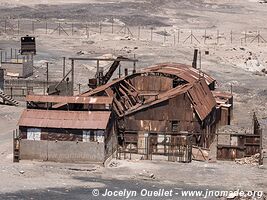
Nowadays, Humberstone is an interesting ghost town. In its heyday, it was a lively town with a grand theatre, a large swing pool, a ballroom, a school...
—
Nov 12, 2019 — Chile
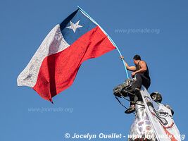
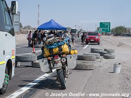
Surprise! It is a national protest day in Chile. All around the country, the main roads have been blocked for many hours.I am at the entrance of the village...
—
Nov 11, 2019 — Chile
Following the breakdown of my motorbike in the Huasco salt flat, members of the group offered me to stay a few days in their bunker. One of theirs, with...
—
Nov 7, 2019 — Chile
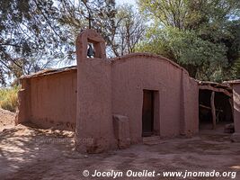
Small church lost in the middle of nowhere. There was nobody around the place. The village of Isluga is vacant during a large portion of the year. It...
—
Nov 6, 2019 — Chile
Salar de Surire Natural Monument is an enormous salt flat (with borax) located at an altitude of 4245 metres. It is almost entirely contained within the...
—
Nov 5, 2019 — Chile
I continue to drive in this reserve located directly south of the Lauca National Park. It is a region with fantastic landscapes.Curiously, I didn't see...
—
Nov 3, 2019 — Chile
Starting from Putre, I begin several days of an expedition in the high mountains of northern Chile. I will pass through several parks and salars (salt...
—
Nov 1, 2019 — Chile
From Arica, I did a few excursions in the backcountry, but without reaching the highlands. My first loop was on the route called the Missions Road, then...
—
Oct 29, 2019 — Chile
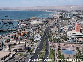
After an easy crossing at the border, my first stop is Arica. Even with a population of 233,000 inhabitants, the city is pleasant and calm. It is a very...
—
Oct 20, 2019 — Peru
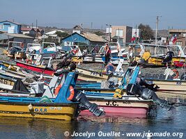
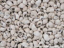
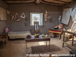
While stopping close to the ocean, I stumbled upon this peculiar fishing area. I don't know which kind of shell they are, but I think it was fairly excessive...
—
Oct 19, 2019 — Peru
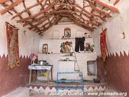
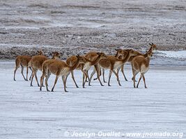
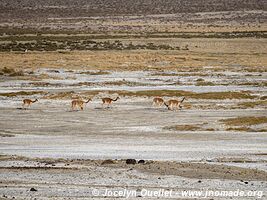
After Nazca, I make a detour towards the mountains before going back to the coast. I want to see a fairly rare species of animal; the guanaco. I visited...
—
Oct 16, 2019 — Peru
The first time I passed through the village of El Chaco, gateway to the Paracas National Reserve, I saw way too many tourists for my taste and I was completely...
—
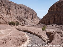
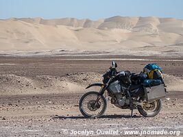
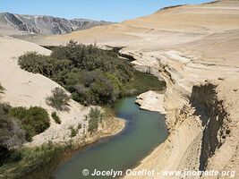
Oct 14, 2019 — Peru
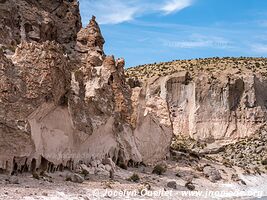
The cañon de los Perdidos is often translated as the Lost Canyon, but I prefer the name Canyon of the Lost People. Indeed, before reaching the region...
—
Oct 13, 2019 — Peru
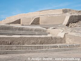
The site of Cahuachi was an important ceremonial centre of the Nazca culture, from AD 1 to 500.The site of 1.5 km2 contains more than 40 mounds topped...
—
Oct 12, 2019 — Peru
This small museum is dedicated to Maria Reiche, an archeologist and mathematician who devoted a large part of her life to the study and conservation of...
—
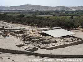
Oct 6, 2019 — Peru
Tambo Colorado has been a military and urban administrative centre around AD 1140 and 1532.The complex was built with adobe bricks following the tradition...
—
Oct 2, 2019 — Peru
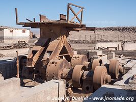
Huancavelica is an old mining town founded in 1571. The main resources of the region were mercury and silver. When the mine was operating, the town has...
—
Oct 1, 2019 — Peru
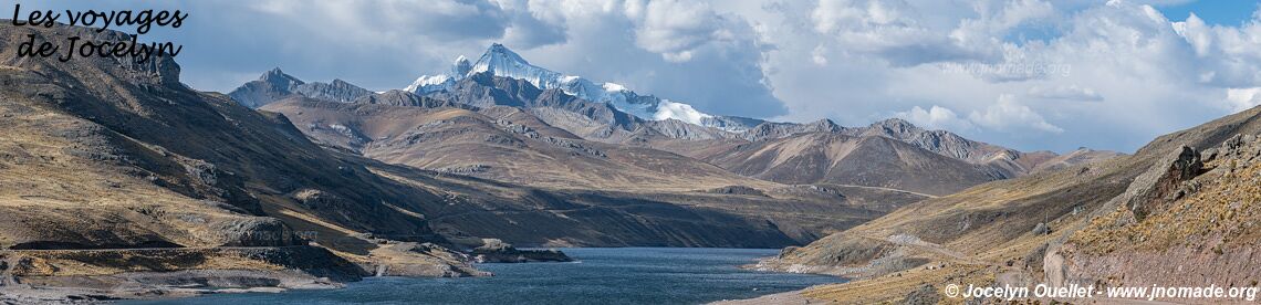
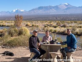
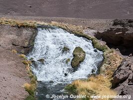
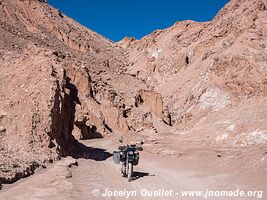
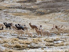
This itinerary of 220 kilometres was very interesting since there were so many llamas in the fields (especially near the Nor Yauyos-Cochas Reserve). At...
—
Sep 29, 2019 — Peru
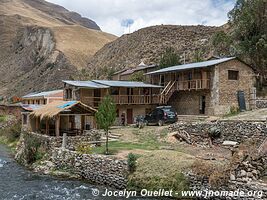
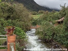
Vilca, as the two other villages shown in this post, is located in the Nor Yauyos-Cochas Landscape Reserve.It is a pretty and quiet village where the...
—
Sep 27, 2019 — Peru
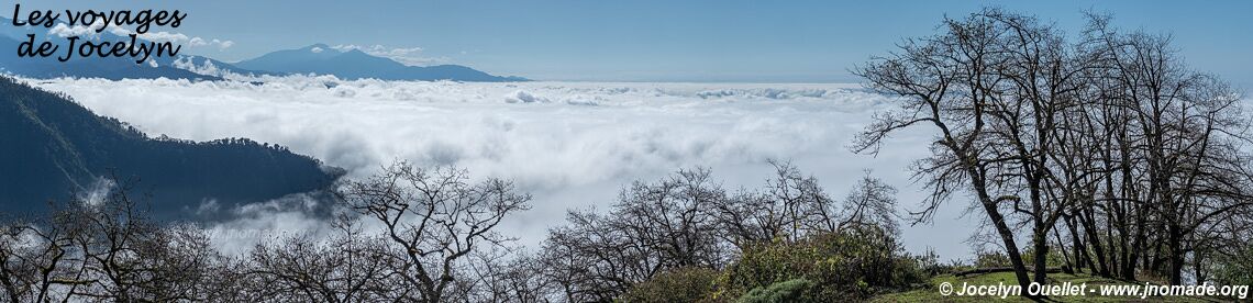
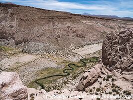
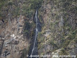
The Nor Yauyos-Cochas Landscape Reserve protects a mix of magnificent snowy mountains, bright blue-green lakes, canyons, and rivers.It's not a hidden...
—
Sep 26, 2019 — Peru
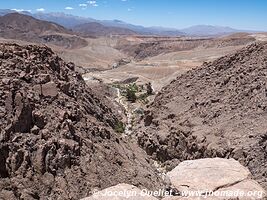
After more than one week in Lima, I am heading to the Central Highlands. From San Mateo, I leave the main road behind and head into the outback.It was...
—
Sep 19, 2019 — Peru
Back on the coast after a few weeks in the mountains. The archeological site of Cerro Sechín dates from 1600 BC, and was discovered in 1937.The main...
—
Sep 14, 2019 — Peru
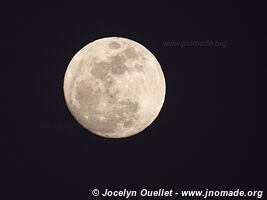
After the canyons, I took a few days off in the town of Caraz.From my hotel room, I was seeing the Cordillera Blanca. A magnificent show just after sunset...
—
Sep 10, 2019 — Peru
In the region I am about to visit, the most famous canyon is Cañon del Pato or, in English, Canyon of the Duck. However, before reaching that canyon...
—
Sep 8, 2019 — Peru
One of my favourite activities; no history to read, no need to speak a foreign language, no schedule to follow...Just the simple pleasure of driving my...
—
Sep 6, 2019 — Peru
Around Huamachuco, three sites are worth a visit if you like ruins from ancient civilizations. Even if you don't like ruins, I recommend a quick visit...
—
Sep 5, 2019 — Peru
A nice drive in the Andean Mountains over a distance of about 150 kilometres.The altitude is around 2750 metres. Second day driving toward Huamachuco...
—
Sep 3, 2019 — Peru
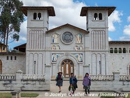
The church, also known as Santuario Virgen del Rosario de Polloc, is also a very interesting excursion around Cajamarca.It is one of the nicest churches...
—
Sep 2, 2019 — Peru
Cumbemayo is an astounding example of pre-Inca engineering. This aqueduct, built more than 2000 years ago, extends over an incredible length of 9 kilometres...
—
Aug 30, 2019 — Peru
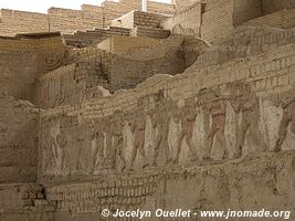
El Brujo consists of three different structures (huaca), with one that is especially impressive for its mural reliefs.The complex was mainly used from...
—
Aug 28, 2019 — Peru
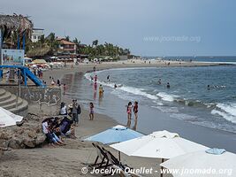
Pimentel is a nice coastal village located 12 km from Chiclayo. During the high season, its beaches are busy with numerous locals. The beach is suitable...
—
Aug 24, 2019 — Peru
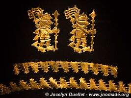
The Sicán culture thrived in the Lambayeque region from AD 750 to 1375. The Nation Museum of Sicán shows some beautiful golden artefacts from that culture...
—
Aug 22, 2019 — Peru
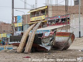
The Pacific Coast of Northern Peru is a mix of beauty and horror. There are few nice villages and small towns with nice beaches, but the majority of the...

—
Aug 20, 2019 — Ecuador
After three months in Ecuador, the country is now one of my favourite. I like everything in this small country; the mountains, the markets, the villages...
—
Aug 19, 2019 — Ecuador
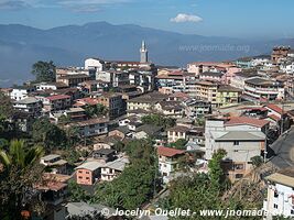
It's the end of my visit in Ecuador. I am heading toward the small town of Zaruma for a night, and the next day, I will cross the border and enter Peru.Curiously...
—
Aug 16, 2019 — Ecuador
The Cajas National Park, only 30 kilometres from Cuenca, is a vast mountainous area of páramo and glacial lakes. This very wet and foggy region is considered...
—
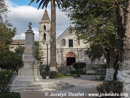
Aug 14, 2019 — Ecuador
Cuenca is one of the most beautiful cities in Ecuador after Quito. The capital is more impressive, but it's not a city where I would like to live since...
—
Aug 8, 2019 — Ecuador
I am now driving towards the town of Baños.As usual, instead of going by a fast-paved road, I drove some small mountain roads in order to enjoy the scenery...
—
Aug 5, 2019 — Ecuador
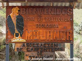
A nice excursion near Otavalo is to go to the Lagunas de Mojanda at an altitude of 3720 metres. A popular place of interest is to visit the Mitad del...
—
Aug 1, 2019 — Ecuador
Mindo is a small village known for the number of bird species in its surroundings; more than 400 have been observed. However, during the nice season...
—
Jul 11, 2019 — Ecuador
I'm still exploring the Cayambe-Coca National Park from the city of Cayambe. Yes Cayambe is a city, a park, and a volcano.This time, I went to the mountain...
—
Jul 9, 2019 — Ecuador
The park is home to Cayambe Volcano, the third-highest summit of the country with a height of 5790 metres. It's a vast territory that I explored from...
—
Jul 7, 2019 — Ecuador
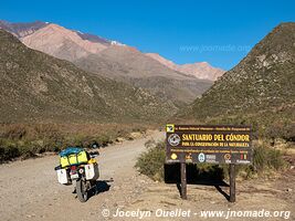
I went to Laguna de Secas to see condors. On the internet, everybody says that they are easy to observe. It was the truth!On the previous photo, there...
—
Jul 5, 2019 — Ecuador
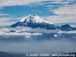
The Cotopaxi Volcano is a magnificent symmetrical cone covered by a glacier. To see this awesome summit in all its glory requires a bit of luck since...
—
Jul 2, 2019 — Ecuador
The Quilotoa is a crater lake, with a width of about 3 kilometres, that was created after the collapse of a volcano that erupted some 600 years ago. The...
—
Jun 30, 2019 — Ecuador
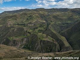
The Quilotoa loop is a circular road going around the famous Laguna Quilotoa. It's a popular itinerary with hikers since the roads and trails cross picturesque...
—
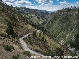
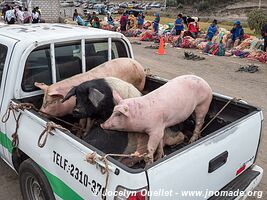
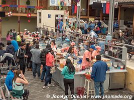
Jun 27, 2019 — Ecuador
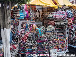
The market in Saquisilí has been one of the most impressive I've seen in Ecuador. The day starts with the animals market, on the outskirt of town, and...
—
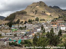
Jun 26, 2019 — Ecuador
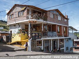
The small town of Pujilí is host to an interesting biweekly market. The market is located in the centre of town, on the central plaza.You will notice...
—
Jun 25, 2019 — Ecuador
Here are more photos of the magnificent mountains of Ecuador.I'm still following the Trans-Ecuador Trail, and consequently, I meet courageous cyclists...
—
Jun 23, 2019 — Ecuador
Salinas is a superb village very popular with travellers and locals alike. In addition to being picturesque, Salinas could be described as a small gastronomic...
—
Jun 21, 2019 — Ecuador
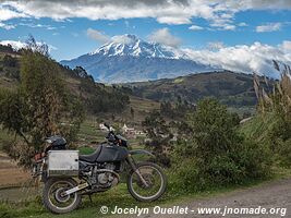
The Chimborazo volcano is the tallest mountain of Ecuador at 6263 metres. Due to the shape of Earth, the Chimborazo is both the furthest point from the...
—
Jun 16, 2019 — Ecuador
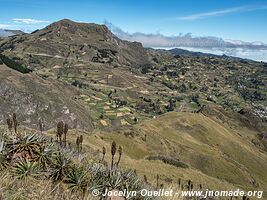
The mountains of Ecuador are magnificent, but they can hide a few surprises. A few parts of my itinerary follow the trail called Trans-Ecuador. The trail...
—
Jun 15, 2019 — Ecuador
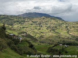
My journey through the mountains of Ecuador is still going on. The landscapes are still spectacular. On these mountain roads, there are often road signs...
—
Jun 13, 2019 — Ecuador
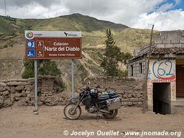
Nariz del Diablo means the Devil's Nose. It's a superb region with fantastic landscapes, but also where the Trans-Andean train was crossing a steep cliff...
—
Jun 11, 2019 — Ecuador
Departing from Guayaquil on the coast, I head toward the Andean Mountains. It's the longest mountain range in the world with a length of 7100 kilometres...
—
Jun 9, 2019 — Ecuador
As I write these lines, I have been in Ecuador for almost 6 weeks. My first stop in the country has been the town of Tulcán, a pleasant mountain town...
—
Jun 8, 2019 — Ecuador
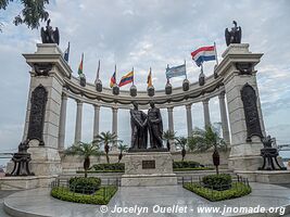
Here is the second part of my stay in Guayaquil.Park Bolivar is also nicknamed the park of iguanas because of the many reptiles that permanently lives...
—
Jun 7, 2019 — Ecuador
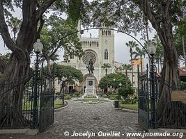
Guayaquil is the second city in importance in Ecuador after the capital Quito. However, it's the economic heart of the country with its 2.7 million inhabitants.It's...
—
Jun 3, 2019 — Ecuador
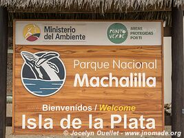
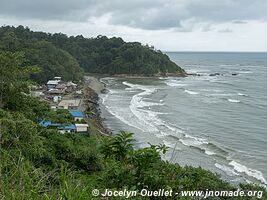
Machalilla Park is the only coastal park in Ecuador. Created in 1979, the park protects about 50 km of beaches, 400 sq km of tropical dry forest, and...
—
May 28, 2019 — Ecuador
When I was in panama, in the oppressive heat, I was dreaming of the mountains with its colder climate. But before exploring the Ecuadorian mountains...
—
May 26, 2019 — Ecuador
Some magnificent scenery on the trail from Tulcán to the Pacific Coast...
—
May 20, 2019 — Colombia
Welcome to South America!I completed the first step of my great journey of explorations through the Americas. I am on the other side of the famous Darien...